

What Is 3D Digital Imaging in Construction?
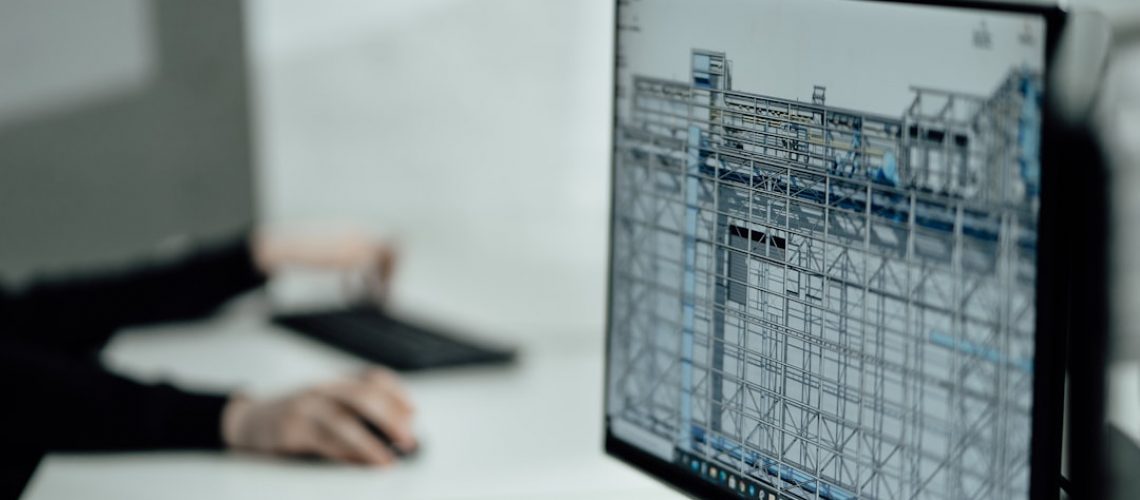
3D digital imaging in construction, also called reality capture or high-definition surveying (HDS), uses laser or LiDAR technology to measure every visible surface of a building and record those measurements as a dense cloud of spatial data points. That point cloud is then processed into a navigable digital twin: a photorealistic, measurable model of the space that any member of your team can access from a browser, anywhere in the world.
The output is not a photograph and not exactly a 2D drawing. It is a spatially accurate representation of exactly what exists on-site at the moment of capture, including wall positions, ceiling heights, MEP routing, structural elements, and equipment placement. Every surface that a laser beam can reach becomes a measured, queryable data point. According to Harper Surveying, these point clouds integrate directly with BIM workflows and digital twin applications, making them usable across the full project lifecycle from pre-construction verification through long-term facilities management.
For operations and project leaders managing retail remodels, prototype rollouts, tenant improvements, or capital planning across multiple locations, this matters for one specific reason: you stop relying on drawings that may be ten years out of date and start working from a current record of actual conditions. The three-step process that makes this possible, Plan, Scan, and Process, is straightforward once you understand what happens at each stage.
Step 1: Planning the Scan, Scope, Access, and Technology Selection
The quality of a 3D scan is determined before the scanner arrives on-site. Planning defines which areas get captured, at what level of detail, and in what output format. Skip this step, or do it loosely, and you end up with gaps in the data that require a return visit, which is exactly the problem 3D imaging is supposed to eliminate.
Scope definition answers specific questions: Does the scan need to capture MEP systems above the ceiling plenum, or only finished surfaces? Are structural elements critical, or is this primarily for as-built floor plan documentation? Does the client need millimeter-accurate point cloud data for Revit modeling, or a photorealistic digital twin viewer for remote design review? Each answer affects which technology gets deployed, how many scan positions are needed, and how long the site visit takes.
Technology selection follows from scope. Laser scanners capture precise geometric data across large spaces at high accuracy. Matterport Pro3 pairs depth-sensing with high-resolution panoramic imagery, producing both accurate spatial measurements and photorealistic walkthroughs that non-technical stakeholders can navigate without any specialized software. For most commercial interiors, the Matterport Pro3 delivers the combination of measurement accuracy and visual fidelity that design, construction, and facilities teams actually need.
Access and logistics planning is equally concrete. For operating retail stores and hospitality venues, scans are typically scheduled during low-traffic hours, early morning, overnight, or between service periods, to avoid disrupting customers and staff. Site managers need to know which areas will be accessed, whether restricted spaces like back-of-house or electrical rooms are in scope, and what, if anything, needs to be moved or staged before the technician arrives. In practice, the prep required from the site team is minimal. The planning burden sits with the scanning provider, not the location manager.
IFTI PROvision’s 20-plus years of commercial building experience shapes this phase directly. A technician who has scanned hundreds of retail and hospitality environments knows to ask about ceiling plenum access, to flag potential scanner interference from reflective surfaces like glass cases or polished floors, and to confirm that the agreed deliverable format actually matches the downstream tool the project team uses. That knowledge prevents the gaps that generate repeat visits.
Best Fit Use Cases for 3D Digital Imaging
- Complex remodels where existing drawings are outdated or missing
- Brand refresh or prototype rollouts requiring consistent documentation across many locations
- Tenant improvement projects with limited access windows
- Facilities documentation for long-term asset management and capital planning
- Active construction progress monitoring and quality assurance
Step 2: On-Site Data Capture, What Actually Happens on Scan Day
The technician arrives with a scanner mounted on a stable tripod and works through the space systematically, placing the device at a series of predetermined positions. At each position, the scanner emits laser beams in a full 360-degree sweep. The device measures the return time or phase shift of each beam to calculate the precise distance from the scanner to every visible surface, producing millions of individual 3D data points per position. Tejjy Inc. describes this as high-definition surveying: non-destructive, non-intrusive, and significantly faster than manual measurement methods.
Multiple scan positions are required to cover an entire space without blind spots. The technician staggers placements so that each position captures what the previous one could not see around corners, behind fixtures, or across large open areas. Before leaving the site, the technician verifies coverage using the scanner’s onboard software, confirming that no areas were missed and that all positions have sufficient overlap for accurate registration in post-processing.
For photorealistic capture with the Matterport Pro3, each scan position also captures high-resolution panoramic imagery, which gets fused with the depth data. The result is a model where you can click any surface, read its measurement, and still see exactly what the space looks like: the flooring material, the ceiling tile condition, the location of every outlet and fixture. Remote team members get the spatial data a designer needs and the visual context a project manager needs, in one file.
The process is quiet, requires no special preparation from store or facility staff, and does not require the space to be cleared. An experienced technician can complete a typical retail or restaurant location in a single visit, often within a few hours. The site team’s role is simply to grant access and stay aware that the scanner needs unobstructed sightlines during each position, a matter of seconds per setup.
Step 3: Processing, Modeling, and Delivering Usable Outputs
After the scan team leaves, the raw data goes through a structured processing workflow before it reaches your project team. This is where millions of individual measurements become the files your designers, contractors, and facilities managers can actually use.
Registration aligns all scan positions into one unified coordinate system. Each position overlaps with its neighbors, and the processing software uses those overlaps to stitch every position into a single, spatially consistent model of the entire space. Cleaning follows: noise caused by reflective surfaces, moving objects captured during scanning, and scanner artifacts is removed to produce a dataset that accurately represents only the physical environment.
From there, the workflow branches based on the deliverable format agreed during planning. For BIM integration, surfaces and structural elements are reconstructed as parametric Revit elements, a process called Scan-to-BIM, producing a model that works directly in Revit or AutoCAD for design coordination and clash detection. For facilities management, the point cloud or digital twin viewer gives asset managers a current, measurable record of every space without requiring BIM software. For construction documentation, the digital twin viewer lets any stakeholder with a browser link navigate the space, take live measurements, and annotate conditions without traveling to the site.
Leica Geosystems identifies as-built documentation, clash detection, and rework avoidance as primary applications of this workflow. Reconstruct adds remote quality control, virtual progress monitoring, and liability protection through precise documentation of existing and constructed conditions. Autodesk’s construction research indicates that laser scanning can cut documentation costs by up to 50 percent compared with traditional 2D methods, largely through faster data capture and the elimination of rework driven by undocumented field conditions.
For multi-location enterprises, the practical result is a consistent, current, measurable digital record for every store, hotel room block, or facility in your portfolio. Remote project teams stop making decisions based on outdated drawings and start working from the actual space as it exists today.
Want to see what a PROvision digital twin looks like for a space like yours?
Why 3D Imaging Makes Sense Specifically for Multi-Location Portfolios
The business case for 3D imaging changes depending on how many locations you manage. At a single site, the value is real but bounded: faster documentation, better design coordination, fewer surprises during construction. Across fifty or two hundred locations, those gains compound into something structurally different.
Outdated as-built drawings are nearly universal in older retail and hospitality portfolios. A brand refresh that hits thirty locations will encounter thirty slightly different existing conditions, most of them undocumented at the level of detail a remodel contractor needs. When the contractor encounters an unexpected condition on-site, that gap becomes a change order. When the same gap appears at twenty locations, the change orders collectively exceed the cost of having scanned every site in advance. Multivista confirms that 3D scanning supports fewer installation errors, improved coordination, and better retrofit support, outcomes that matter most precisely when you are running the same program across many sites simultaneously.
Scheduling is the other lever. Sites with limited access windows, flagship retail locations that cannot close during peak season, hotel properties that cannot take rooms offline, restaurants that need every hour of service, require documentation methods that capture complete information in a single short visit. A 3D scan accomplishes that. A tape measure and a part-time drafter do not.
Remote coordination is the benefit that enterprise teams often underestimate until they use it. When every location in a portfolio has a current, navigable digital twin, a design director in New York can review ceiling heights in a Phoenix store, a contractor in Dallas can verify rough-in dimensions in a Houston location, and a facilities director can compare equipment placements across six hotels, all without booking a flight. Existing Conditions notes that 3D laser scanning is particularly cost-effective for documenting interior and MEP conditions, which are exactly the conditions that drive construction surprises when they are unknown.
Why Multi-Location Teams Trust IFTI PROvision
Choosing a scanning provider for a single location is a limited commitment. Choosing one for a portfolio program is a different decision, because inconsistency in the provider’s output creates inconsistency in your construction outcomes. IFTI PROvision is built specifically for enterprise programs, and four things separate it from generic scanning services.
20+ Years of Commercial Building Expertise
PROvision is backed by the same team and quality standards behind IFTI’s industry-leading building testing and inspection work. That experience shapes every scan: how scope is defined, what gets flagged during site planning, and how deliverables are structured so they actually work in a construction or facilities workflow rather than sitting unused.
Matterport Pro3 Technology
PROvision deploys Matterport Pro3, which captures millimeter-accurate depth data fused with photorealistic panoramic imagery. The result is a digital twin your teams can navigate like a virtual walkthrough and measure like a real space, from any device. No specialized software is required to access or annotate the model.
Nationwide Technician Network
Scaling 3D imaging across a portfolio requires consistent results at every location, not just the ones near a major market. PROvision is delivered through the same vetted network of 300-plus technicians across the U.S. and Canada behind IFTI’s floor testing services, with standardized methods and quality controls designed for enterprise-scale programs.
Professional-Grade Deliverables at Enterprise Scale
PROvision delivers consistent file formats, reliable measurement accuracy, and deliverables that integrate with Revit, AutoCAD, and facility management platforms. Whether the program covers a handful of pilot locations or two hundred stores, the output quality and the workflow integration are the same at every site.
Frequently Asked Questions
What does a 3D digital imaging scan actually produce?
A 3D digital imaging scan produces a point cloud, a dataset of millions of spatially accurate measurements of every visible surface in a space. That point cloud is then processed into one or more deliverables: a navigable digital twin viewable in a browser, a BIM model compatible with Revit, CAD-ready files, or a combination depending on project needs. All deliverables carry live measurement capability.
How long does a 3D scan take on-site?
A typical retail or restaurant location can be captured in a single visit, often within a few hours, depending on square footage and the number of areas in scope. Larger facilities or multi-floor buildings require more scan positions and proportionally more time. Precise timing depends on scope definition agreed during the planning phase. No special preparation from site staff is required beyond access.
Will the scanning process disrupt an open store or operating facility?
3D laser scanning and Matterport capture are non-intrusive processes. The scanner sits on a tripod and requires only clear sightlines during each position, a matter of seconds. Scans of operating retail and hospitality venues are routinely scheduled during low-traffic hours to minimize any impact. No construction, drilling, or physical alteration of the space is involved.
What file formats are delivered and how do they integrate with BIM or CAD workflows?
Standard deliverables include point cloud files (.rcp, .e57, or similar), Matterport digital twin links accessible via browser, and Scan-to-BIM models compatible with Revit and AutoCAD. The specific format is agreed during the planning phase based on downstream workflow needs. Deliverables are intended for planning and design reference and are not certified survey or engineering documents.
Can 3D imaging scale consistently across dozens or hundreds of locations?
Yes, provided the scanning provider has a geographically distributed technician network and standardized methods. IFTI PROvision uses a network of 300-plus vetted technicians across the U.S. and Canada with consistent equipment, protocols, and quality controls. Consistent inputs produce consistent outputs, which matters when documentation quality directly affects construction outcomes across a portfolio.
What types of construction projects benefit most from 3D digital imaging?
The highest-value applications are complex remodels where existing drawings are outdated or missing, prototype rollouts requiring identical documentation across many locations, tenant improvement projects with narrow access windows, and facilities documentation for asset management or capital planning. Any project where unknown existing conditions create risk of change orders or rework is a strong candidate for pre-construction scanning.
Is laser scanning the same as a standard photo survey or video walkthrough?
No. A photo survey documents appearances but carries no spatial data. A 3D laser scan or LiDAR capture records precise distances from the scanner to every visible surface, producing a measurable dataset. Matterport Pro3 combines both: millimeter-accurate depth data fused with photorealistic panoramic imagery, so the digital twin is both visually navigable and dimensionally accurate for planning use.
Put 3D Digital Imaging to Work Across Your Portfolio
IFTI PROvision delivers professional 3D digital imaging for multi-location retail, hospitality, facilities, and commercial real estate programs, backed by 20-plus years of building expertise and a 300-plus technician network across the U.S. and Canada.
Sources
- Harper Surveying. “Top 5 3D Scanners for Construction: Enhancing BIM & Surveys.” Published March 5, 2025. Updated September 8, 2025. harpersurveying.com
- Tejjy Inc. “How 3D Laser Scanning Enhance BIM & Construction Accuracy?” Published March 17, 2024. Updated March 13, 2026. tejjy.com
- Multivista. “3D Scanning in Construction.” multivista.com
- Matterport. “Matterport Pro3 Camera.” matterport.com
- Leica Geosystems. “3D Laser Scanning in Construction.” leica-geosystems.com
- Reconstruct. “Benefits of 3D Scanning for Construction.” reconstruct.ai
- Autodesk Construction Blog. “Laser Scanning in Construction.” construction.autodesk.com
- Existing Conditions. “3D Laser Scanning Services.” existingconditions.com
This content is for general informational purposes only. Deliverables, pricing, and turnaround depend on project scope and site conditions. Measurements are for planning reference and are not a substitute for certified survey or engineering documents. PROvision is a service of IFTI.